Blue Mountains, Australia, History
Historic MapKatoomba Bushwalks |
From
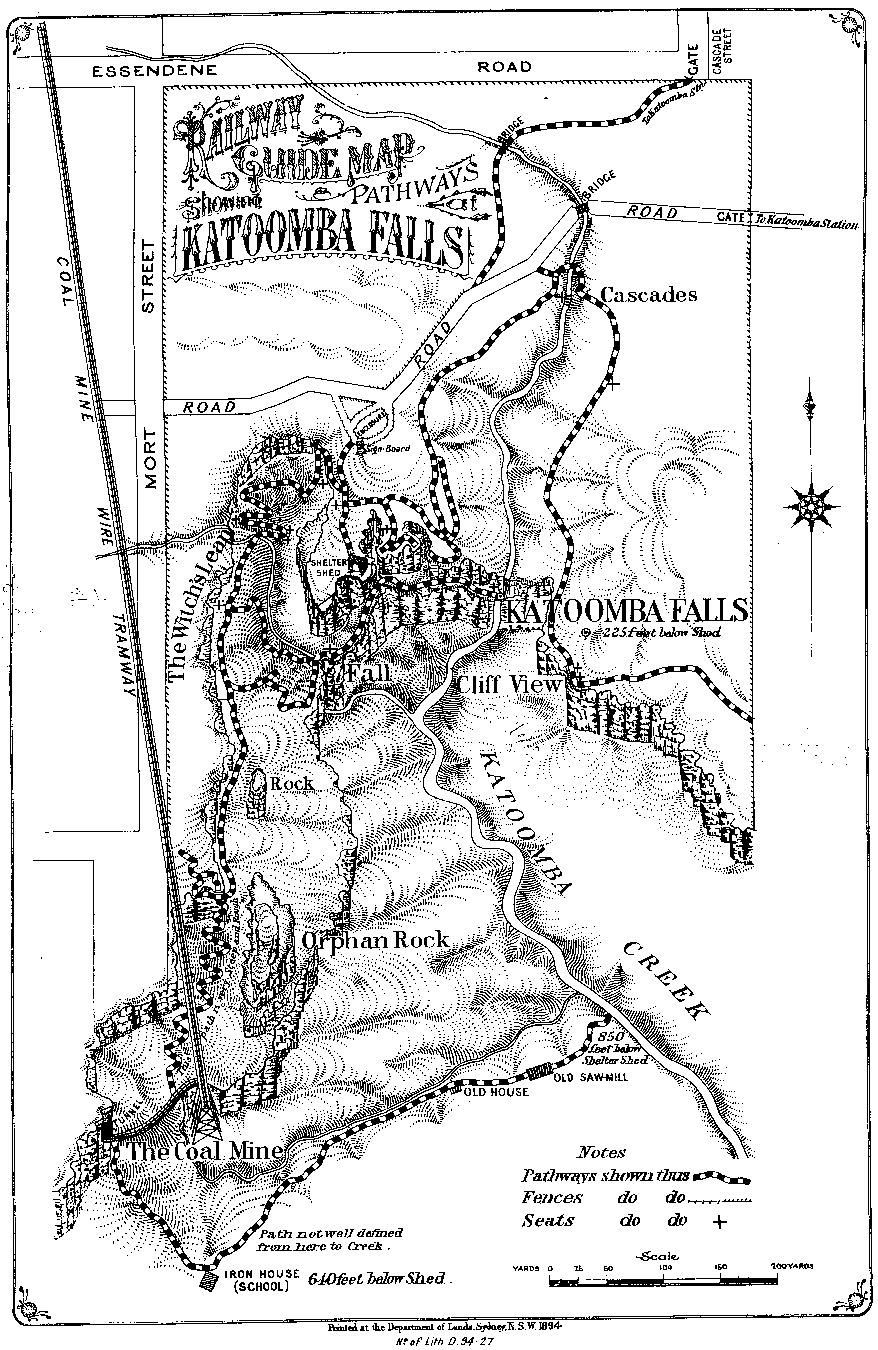
the "Blue Mountains Railway Tourist Guide" Map printed by Department of Lands, 1894. Please be patient whilst the map downloads -- it is a 74Kb GIF file. |
Noteable ItemsCoal mine wire tramway. The section down through the cliffs remains to this day as the Katoomba Scenic Railway, so you can take a ride on it. It is the steepest incline railway in the world, reaching a hair-raising 52 degrees! The tramway was operated by wire ropes, as the Scenic Railway still is. "Iron house (school)", "old house" and "old sawmill" in the valley below the coal mine. Can anyone supply information about these? Tramway leading into coal mine. This
dual-track cable-operated line continued out the other side, crossed a trestle bridge,
tunnelled under Narrow Neck via the Daylight Tunnel, and continued down to kerosene shale mines in the Megalong Valley. A horse-drawn
branch line ran out to more mines at the Ruined Castle. It is interesting to see photos, from this era, of bushwalking parties in the Blue Mountains. Their clothing, particularly the ladies, was not very appropriate for the task! |

"Blue
Mountains Railway Tourist Guide" is held in the local history archives of the Blue
Mountains City Library at Springwood. |
| Info Entrance History Plaza |
Activities Info... Railway Pages... Picture Gallery... Tourist Info... |
Add your Web site... Bibliography... |
| Free Fonts | ||
| Used here | Host |
Blue Mountains, near Sydney, New South Wales (NSW), Australia.
| A
link to your Web site from Info Blue Mountains. More
info... Copyright 1997-2003, David Martin, except where other copyright applies. Company, brand and product names are the property of their respective owners. |