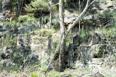
Info Blue Mountains Railway Pages
Cable Inclines
at
Mt Victoria
3 Sisters, Blue Mountains, Australia.
Blair Athol, Chert & Hartley Vale Inclines
Bushwalking, cycling, industrial archaeology, mining.

Blue Mountains Australia

Blair Athol Mine No.4, a Colliery Incline

A short bushwalk with ruins, a tunnel, & moderate gradients. Take a torch.

As you approach Mt Victoria from Katoomba, go down Victoria Falls Rd on your right just past the playing fields which are on your left. Drive along until you come to the overhead power lines (less than 2km) & park. Walk (or cycle) down to your right along the cleared area under the lines, about 250m. You should see a cross track, then a track going off to your left. There is a sign indicating that the mine is 500m away. Turn left onto this track- it will take you to the head of the funicular incline, which you then walk or cycle down. It is reasonably smooth, not steep, but trees have grown on it. Notice the rock cuttings, embankment, gravel surface & other remains.

The incline continues into the pit (Blair Athol No4 Mine) as far as the water level so take a torch. It descends at 15º until water is reached at a sump approximately 200m from the entrance. The coal seam is a further 100m down, below the water. Watch for glow worms. At the entrance to the pit should be a visitors book, maintained by the national park authorities, which gives a bit of the history of the mine.

Original information supplied by Ian L. Checked in the field & enhanced by the editor.

See also Glow Worm Tunnel... 

Glow worms are sensitive to habitat disturbance, in particular, noise, lights and pollution from smoke and exhaust fumes. They are also destroyed by touching.


The Chert Incline

Approaching Mount Victoria from Katoomba, look out for Station St on your left as you cross the railway line - it goes down to a park. Drive through the park and onto the railway access track. Go along until you are next to the playing fields on your left. After this start looking along your right, not far after the playing fields you will see the concrete foundations of the steam winder. The start of the incline is reasonably hard to find as all traces have been obliterated at the start but walk around and I'm sure you will come across it.

Information supplied by Ian L.

What is Chert?

My inquiries brought several responses:

Chert (flintstone), containing silica and quartz and possessing good binding properties with small amounts of water, was used as road metal in road construction. In the 1920s the Blue Mountains Shire Council had their own chert quarry on Mount Victoria Pass. The research officer of the Mount Victoria & District Historical Society has researched and written an article on this quarry, a copy of which is held in the library's local studies collection.

Concerning the chert incline mentioned in your correspondent's email, I also have a copy of an article, "Chert Incline, Mt. Victoria, NSW" by F. John Reid, published in Light Railways  (Journal of the Light Railway Research Society of Australia) No.63, January 1979. The tramway incline was built in 1924 and operated by the Mount Victoria Chert Road Metal & Timber Co. Ltd.

Information supplied by John L.

Off the top of my head, chert is the waste from a process involving mineral extraction. (A bit like coal wash.)

Information provided by Vaughan W.

The most prevalent type of artefact found on a prehistoric site is a chert flake. Chert is a coarse type of siliceous rock (a form of flint or chalcedony), which was the primary raw material used by the aboriginal inhabitants of many places for the manufacture of a wide variety of tools including projectile points (spear and arrowheads), drills, knives and scrapers.

Chert occurs naturally under specific geological conditions in bedrock formations, where it can be "mined" or extracted in chunks or nodules. Chert nodules were hammered and flaked into the rough outline of a "biface" or preform, and then finely flaked into a finished tool such as an arrowhead. In the process of making a biface or a finished tool, hundreds of small waste flakes are removed and discarded. Archaeologists frequently first find a scatter of these chert waste flakes (debitage), an important clue towards documenting a site. The waste flakes themselves sometimes have razor-sharp edges which were simply an expedient tool for cutting or scraping, so it is important for the archaeologist to carefully examine the edges of each and every flake. Detailed archaeological excavation of a large camp site might result in the recovery of thousands of chert flakes.

And also, according to http://www.northcoastjournal.com/mar98/3-98.environ.html CHERT = County of Humboldt Extraction Review Team

Information supplied by Geoff L.


In the 1920's, two Sentinel Steam Wagons were purchased by the shire council to carry chert from a quarry on Victoria Pass to the Mt Victoria railway station. Models of these wagons (photo, right) are available from Trains, Planes & Automobiles Sentinel Steam Wagon

Hartley Vale Incline 

Track follows abandoned railway from Darling Causeway to top of the incline. You'll be rewarded by ruins and an excellent view of Hartley Vale & beyond. Best time for photographing the view is morning.
More info... 

Photo: Remains of the winding house, against the cliff at the top of the incline. Note both brick & sandstone construction. The foundations of the winding wheel had to be very securely anchored into the rock.
Photo ©2002 D. Martin


Info Blue Mountains 
Activities Info...
History Plaza...

Photo Gallery... 
Plaza 
Tourist Gateway...
Add your Web site
Bibliography 
Feedback
Railway Pages 
Tour 
Train Services
Visit These Places
Promote your Web site in Info Blue Mountains. Get included.....
Copyright 1997-2003, David Martin,  except where other copyright applies.
Company & brand names are the property of their respective owners.
Established 1996 - originally "Blue Mountains Plaza".

Greater Western Sydney, NSW, Australia
Web Hosting Proudly Sponsored by
Auzzie.Biz Domain Services
Web Site Maintenance Sponsored by
Debweb
 

.